


Agenda revealed/ Extended SP meeting to be held tomorrow
Tomorrow at 10:00, the expanded meeting of the Socialist P...
Tomorrow at 10:00, the expanded meeting of the Socialist P...

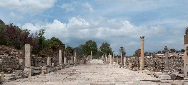
For the first time, researchers have mapped the entire extensive Roman road network, highlighting its extraordinary influence on European relations and history.
"All roads lead to Rome!" Roads were the lifeblood of the Roman Empire, stretching from Britain to North Africa — along them people settled; armies marched; merchants, goods, knowledge, and power traveled — to the farthest reaches of the empire. Even today, the Roman road network continues to shape large parts of Europe, the Middle East, and North Africa.
Now, a major new digital research project is fundamentally changing the way we see this ancient infrastructure. The international academic team behind the Itiner-e project has created the first high-resolution, open-data set mapping the entire road network of the Roman Empire. In total, they have managed to digitally map 299,000 kilometers of roads spanning some 4 million square kilometers of the former empire, almost doubling the length of roads previously thought to exist.
Itinerary: Digital Mapping of the Ancient World
To digitize the network, reliable sources were studied. Researchers searched archaeological sites, travel diaries, and centuries-old maps such as the Tabula Peutingeriana. The historical tracks found were compared with modern aerial and satellite imagery to create Itineraries.
Traces of Roman land division (Centuriation), known not by walls or canals but by plots, as the Romans divided new and conquered lands equally into rectangular blocks — are still recognizable today as paths, roads or boundaries. They are clearly visible in aerial photographs, on cadastral maps and even during walks, especially in northern Italy, southern France and Tunisia.
The researchers ultimately merged 14,769 individual segments into a detailed geographic information system (GIS), accurate to 50 meters, that links each road section with regional metadata, quality indicators, resources, and digital links to information on ancient settlements. This provides, for the first time, a more comprehensive understanding of how people moved around, how empires were administered, and even how diseases spread.
Digital methods and archaeological detective work
In addition to over 100,000 km of main roads, researchers also mapped 195,000 km of secondary roads, visualizing mobility in the most remote areas of the empire.
Another innovation of the team was the use of digital models to simulate the speed, route, and physical obstacles of roads crossing difficult terrain.
Roads: Foundation of the Roman Empire's Power and Mobility
Another innovation of Itinerary is the clear presentation of how the Romans' logistical prowess enabled the massive expansion of the empire — enabling trade, intellectual exchange, and military control of vast territories. Over 100,000 km of main roads crisscrossed the empire, equipped with mileposts, military posts, and administrative centers, and therefore well documented.
The layout of secondary roads reflects the development of regional economies and daily movement. From the data, the researchers noted that some areas retain clear traces of the network even today, while others have been reconstructed through digital analysis based on the history and sources of the areas. The project thus opens up numerous possibilities for future research.
Mapping the Unknown: Why Roman Roads Still Remain a Mystery?
The Itiner-e road atlas also tells a story of uncertainty, as although most roads are documented in written sources, their exact route is often unknown. The reason is related to the different versions of the stories that have survived to this day, topographical changes, and the natural expansion of the road network over the centuries.
Researchers say that only 2.7% of the routes can be mapped with archaeological certainty. In nearly 90% of cases, researchers can only determine a "probable" route. While for the final 7.4%, scientists can only suggest "hypothetical" routes that the routes should have followed.
The dataset also includes "Credibility Maps," something completely new in archaeology, which highlight regions and segments that need excavation or better documentary sources.
Re-measuring Roman roads means rewriting European history
One thing the Itiner-e project makes clear: the paths of history are much longer and more complicated than previously thought.
With this project, researchers have uncovered major gaps, but at the same time they have also opened new avenues for fascinating stories and new discoveries. Every archaeological gap is an invitation to continue research./ DW


Nearly seven months after his election as pope, Leo XIV un...
Një ngjarje e rëndë ka ndodhur në Kinën jugperëndimore, ku...
A magnitude 6.6 earthquake struck a small island northwest...

At least 44 people have been killed in a massive fire that...

The US has suspended processing of all immigration applica...

Venezuelan President Nicolas Maduro donned military unifor...

President Donald Trump has announced the exclusion of Sout...

US President Donald Trump has reacted after the injury of ...

New York City is enveloped in a very pleasant atmosphere b...

Former Peruvian President Martin Vizcarra was sentenced to...
Gunshots have been recorded near the White House. Foreign ...
Senior Ukrainian security official Rustem Umerov, a key fi...

NATO Secretary General Mark Rutte warns that even if an ag...

French President Emmanuel Macron will pay an official visi...
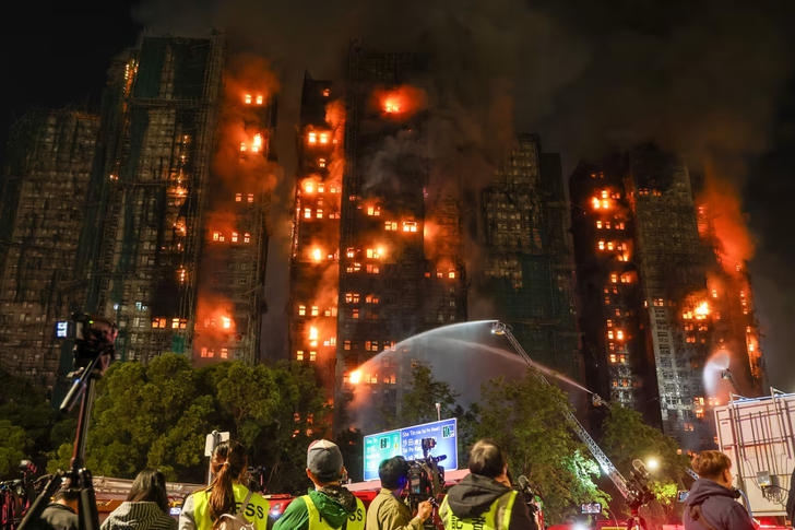
The death toll from a fire that ripped through a Hong Kong...

Kosovo Police have arrested a Turkish citizen who is inter...
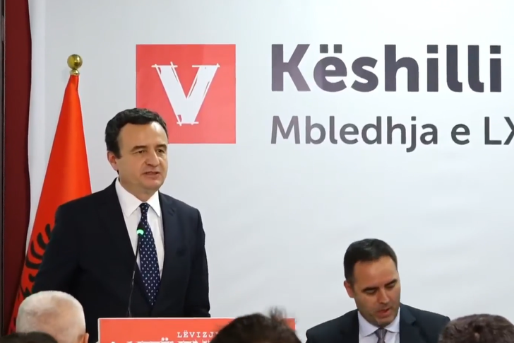
The General Council of the Vetevendosje Movement has chose...

AAK leader Ramush Haradinaj has expressed his condolences ...

A Georgia prosecutor has dropped the indictment against Pr...

A Turkish court has sentenced a prominent independent jour...
In January 2026, CNA published a series of documents and f...

Erion Isufi is the man known in the media as Lulzim Basha'...

There have been 12 days of protests in the capital, which ...
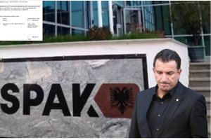
Dritan Prençi is the SPAK prosecutor who is sleeping on th...

The Special Board of Appeal (KPA) decided this Monday ...

The KPA vetting decided this Thursday to dismiss the p...

Suela Salavaçi, a prosecutor in the Prosecutor's Offic...

The Special Board of Appeal reinstated the prosecutor ...

Tirana Police have arrested today the perpetrator of the t...

Four hand grenades and two automatic weapons were found in...

Tirana Police have cracked down on a case of document forg...

Other details have emerged from the murder of Eglant Koç, ...
On Friday, our country will be affected by stable weather ...

On Thursday, our country will be affected by stable weathe...

On Wednesday, our country will be affected by relatively s...

Meteorologist Tanja Porja shared some predictions today re...

Andy Burnham is no stranger to Labour Party leadership con...

A fire broke out this Friday at an elementary school in ce...

Attorneys for the defendant accused of killing UnitedHealt...

The parents of a boy who fatally shot nine children and a ...

The Albanian Embassy in Switzerland has organized an eveni...

This Wednesday, the prominent actor of Albanian cinema, Gj...
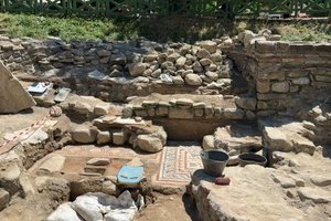
Several archaeological excavations conducted during this s...
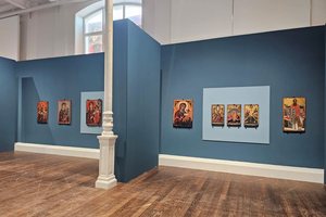
At the Museum of Fine Arts in Chambéry, France, an exhibit...

The Minister of Economy and Innovation, Delina Ibrahimaj, ...

The draft law proposed by the Ministry of Finance for a ne...

It is not only Albanian consumers who pay more than the Eu...

Albanian consumers paid 10.5% more for fuel than the Europ...